PORTUGUESE
STATE
Geopolitical division
In the first half of the XIX century their territory was not
defined as autonomous entity. In
1856 Portuguese became one of the 21 counties in that the country
was divided. In 1864
it became state. In 1881 she/he becomes South state of West, and
in 1909 she/he recovers
the current territory. It is divided in fourteen municipalities
and twenty-two parishes.
MAP VIAL
Between Agua Blanca and Ospino 90 kilometers of freeway exist. The
troncal 5 communicates to the one state with Barinas and Cojedes. Through the troncal 7 she/he
communicates with Lara and Trujillo. Among the most important populations are: Acarigua, Blanca, Araure,
Dilutes Biscucuy,
Boconoíto, Guanarito, Píritu and Villa Bruzual.
Basic DATA
Capital
Guanare
Location
Center-western region
Limits
North: Lara and Cojedes
South: Barinas
This: Cojedes
West: Barinas and Trujillo
Surface
15 200 km2
Percentage of the national territory
1,66%. it is the tenth second entity with bigger surface of the
country.
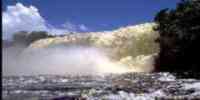
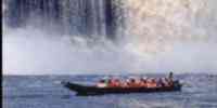
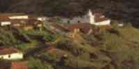
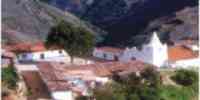
TOURISM
In Guanare she/he is the Basílica Catedral of Our Mrs. of
Coromoto, as well as the one
Sanctuary of the Coromoto, with a monument in the place where the
virgin appeared in 1652. In
the colonial helmet of Guanare is the Museo Inés Mercedes Gómez
Álvarez. In the same one
city the Casacoima that was headquarters of the Compañía
Guipuzcoana and the parks is: Those
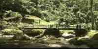
Samanes and Bay of the Cliff. The Spa Fluvial Gulch is in Acarigua
and Araure of
Araure and that of Curpa, the railroad, and the churches: Our Mrs.
of the Pilar, San Fernando of
Ospino and San Miguel Arcángel. Besides the Monument to The
Spike, the Monument to the Battle
Galleys of Araure-the Barrow and the General Museum José Antonio
Páez. In Agua Blanca you
she/he finds the cave King Guaicaipuro's Palace, the Embalse
Majaguas and the Fluvial Spa
The Majaguas. In Biscucuy, the Fluvial Spa The Pionio and the
Caves of the Río Xaguás. In
Guanarito is the refuge of fauna Tideland of Chiriguare.
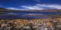
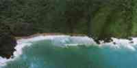
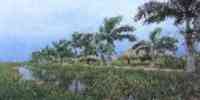
Geography
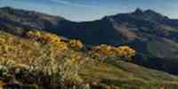
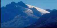
Relief
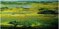
It is characterized by the presence of a great extension of plane
lands, corresponding to the
Natural region The Plains and to the Natural Region you Walk Them.
The piedemonte area and plains
high they present a relief plane, little slope and fertile floors
of alluvial origin subject to
occasional floods, with numerous forests. Another part corresponds
to the low plains,
whose main characteristic is that they are subject to floods of
long duration. Those
estribaciones of you Walk them they are integrated by a group of
lines of mountain ranges. These
mountain landscapes and piedemonte present heights that oscillate
between 400 and 2 200 m.s.n.m., to the one northwest of the entity. It has a great extension of plane lands,
with floors of good
quality and abundance of the resource dilutes. It presents an
important agricultural potential estimated in 60% of their surface. 940 000 exist there is of earth with very
high, high and moderate potential in the plains of the main rivers; near 13% of capable lands for
use agricultural vegetable
and 2 capable% for cattle use.
Climate
The climatic conditions present relative uniformity. The
temperatures stockings oscillate
between 24 and 28 ºC with annual precipitations between 1 200 and
1 900 mm. In the sector where you they locate the mountain landscapes and piedemonte, a wide range
of conditions is presented
climatic associated to the variations of height.
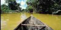
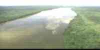
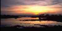
Hydrography
The mountainous area is reservorio of sources of water. The basins
of the rivers are mentioned
Cojedes, Portuguese, Acarigua and Guanare. Other courses of water
are the rivers: Guache, Ospino,
Tucupido, Resident and Bucaral, belonging to the basin hidrográfica
of the river Orinoco. The
resource hídrico is abundant, including the underground waters.
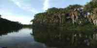
Vegetation
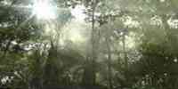
She/he has a wide surface covered with forests, where they can be:
mahogany, cereipo,
jabillo, merecure, palm llanera and puy. The expansion of the
agricultural frontier has caused the
loss of masses boscosas protectors and producers, to substitute
them for exploitations
agricultural and cattle of low yield.
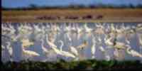
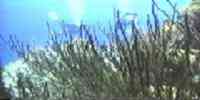
Fauna
There are big mammals, as: deer, danta, bear melero and fox crab
seller. Among the birds
they highlight: duck cariblanco, rosy pick, king zamuro, paují
curly crest, caricare, jay and
chenchena. The most common reptiles are: morrocoy sabanero,
terecay, iguana, snake tail
yellow, snake of water and common toad, as well as a diversity of
species of frogs.
Mineral resources
It has resources non minerals as: sand, limestone, calcareous
magnesiana and it burdens.
Population
She/he has 576 435 hab, being located in the tenth second place
among the federal entities,
according to the XII General Census of Population and Housing
1990. Their density is of 37,9 hab/km2, practically double the national average. Their rate of growth is
of 3,4%. Those
municipalities with bigger population are: Páez (22,94%), Guanare
(20,84%) and Araure (13,15%).
With regard to the populational distribution, the tendency is to
concentrate on the axis Acarigua -
Araure in Guanare; also near the urban population's 70% it is
distributed in those
four main populated centers. The area Acarigua-Araure has
experienced a growth
sustained, ending up becoming the economic capital of the entity,
being able to specialize
as center of services and of support to the agricultural
production.
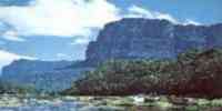
NATIONAL PARKS
It possesses four national parks: Dinira, in the Sierra of
Barbecues, embracing the states
Lara, Trujillo and Portuguese. The Guache, in the beginning of the
Mountain range of you Walk them, in those states Lara and Portuguese. Moor of Guaramacal, in the brunch this
of you Walk Them, to the one occident of the country. Terepaima, to the southeast of
Barquisimeto, in the oriental end of the
Andean mountain range.
Economic ACTIVITY
The main activity is the agriculture. It is one of the main
centers of application of a
it programs to great scale for the modernization of the Venezuelan
agriculture, which was
conceived initially for the cultivation of rice and it influenced
in the gestation of the agriculture
tecnificada; as well as in all the related with the process of the
agroindustrial activity.
At the moment it is the first producing of rice, corn, coffee,
sunflower, ajonjolí and cane of sugar. The second in sorghum, quinchoncho, tomato, sideburn and tobacco; and
the third in yucca, bean and melon. It is also cultivated cotton and caraota. The timber activity is
also of great relevance; the
wooden production in rola places it as the fourth entity of the
country as for production
wooden. The industries have had a considerable increase in the
last years,
especially in the city of Acarigua, where a great sugar center,
plants exists
beneficiadoras of rice and numerous sawmills.
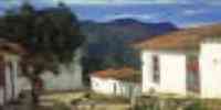
TRADITIONS
One of the most popular legends in the country is the one of
Florentine and the Devil, the battle among the one well and the wrong, the fight among the somber coplero that she/he
wanders wandering for the immensity of the savanna and mandinga, as well as she/he is denominated the devil.
The myth was picked up in a unforgettable poem of Alberto Arvelo Torrealba. Florentine or the
quitapesares represents the the hefty, strong and untamable man's image that is able to defeat
the devil in a long bereavement. The bad she/he retires because the dawn arrives, and the singer loses
the voice for the rest of his days after the confrontation by force of contrapunteos that transformed
it into a legend that you it transmits of generation in generation.


 Eco-Portal
Wildlife Venezuela
Eco-Portal
Wildlife Venezuela 