MONAGAS State
Geopolitical division
In 1568 the Government of New Andalusia
is believed that passes to be
denominated County of
Cumaná. In 1856 the County of Maturín
is established, becoming state Maturín
in 1864.
In 1881 the state settles down it
Guides. In 1901 she/he becomes
autonomous entity, and in 1909
she/he acquires the state form Monagas.
It is divided in ten municipalities and
thirty and a parishes.
MAP VIAL
The road of more important terrestrial
communication is the troncal 10 that the
entity travels of
north to south. It goes by Maturín and
it communicates it with Sucre. To this
the vialidad is connected secondary.
In Shaker a highway takes toward Ravines
and Tucupita. Some populations
they are: Aguasay, Aragua of Maturín,
Ravines of the Orinoco, Caicara, Caripe,
Caripito, Tip of
It kills, Quiriquire and Shaker.
Basic DATA
Capital
Maturín
Location
Northeastern region
Limits
North: Sucre
South: Bolivar and Anzoátegui
This: Delta Amacuro
West: Anzoátegui
Surface
28 900 km2
Percentage of the national territory
3,15%. it is the ninth entity with
bigger surface of the country.
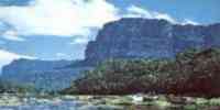
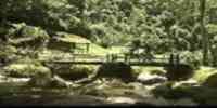
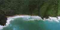
TOURISM
It has the first natural monument
decreed in the country, the Alejandro
Humboldt; the
bigger natural cavern of Venezuela and
one of the most important of the world.
In
Maturín is Juana's vial The Avanzadora,
heroine estadal. In the walk Liberator
you
she/he lifts the Cathedral of Our Mrs.
of the Carmen of Maturín. Also in the
capital it is the one
Municipal park The Guaricha with their
zoological one and their train, and the
Municipal Park Menca of Leoni with
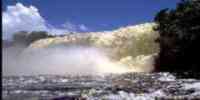
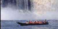
a serpentario. Guayuta is Up in Aragua
of Maturín, with petroglifos of 4.000
years of antiquity and the town of
Aparicio, where the Salto Aparicio, a
fall of water is
that it forms the river Aragua. The
Balneario Maraquero is in Caicara of
Maturín. In Caripe, The
Cave of the Guácharo and several points
to appreciate the work of the artisans
of the area. In
Tip of Bush can visit one another the
spas: New step, Queregua, Lagoon of
Musipán and
The Spurt of Musipán; as well as the
Park The Herons. In Quiriquire they are
the waters
thermal The Bathrooms. In San Antonio of
Maturín, the island of Guara, the
lagoon Cujisanica, the one Spa
Miraflores and the river Long Morichal.
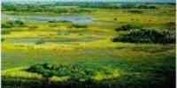
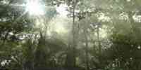
Geography
Geology
The mountain landscape is of geologic
material of age cretácea, constituted
by rocks
sedimentary. To the tables they are
denominated High Plains of Monagas and
it is an extension
altiplana that is subdivided in two
sectors: the piedemonte table and the
flat table. The first one
she/he has a geologic basement formed by
songs, blocks and cobbles. The second
have
silts of the quaternary one: toward the
north of the cretáceo-third and toward
the south the fraction sand. The
plain landscape constitutes the low
plains. The one of it overflows it
presents fluvial silts
of diverse origin: the material of the
deltaic plain is recent, of alluvial
origin. The plain
muddy coastal it is a means of marine
origin. And the alluvial plain of the
Orinoco has
very recent silts.
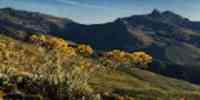
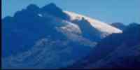
Relief
It is conformed by three landscapes:
mountains (Serranía of Turimiquire),
tables (High Plains) and
plains (Low Plains). That of mountain
presents elevations between 400 and 2
300 m.s.n.m., with
fence and depressions. The topography of
piedemonte table is smoothly inclined,
with
slopes between 2 and 6% and inferior
elevations to 400 m.s.n.m. The flat
table is one
almost plane plateau with slopes of 1 to
2% and elevations smaller than 40
m.s.n.m. The
relief of the plain of it overflows
alluvial of the Orinoco it is plane,
with smaller slopes to 1%,
and some depressions. The floors of the
tables are ultisol, entisoles and
oxisoles. In the table of
piedemonte is of little fertility. In
the flat table there are sectors with
floors of textures
you mediate, those of better physical
conditions for the agricultural
activity. In the plains those
floors are loamy of fine textures and
you mediate of the order inceptisol and
vertisol. In the sector
mountainous they are lands associated
with rocky blooming, of moderate to low
fertility and
high susceptibility to the erosion.
Climate
Two climatic types exist according
to the classification of Köeppen: the
savanna climate (Aw), with
high temperatures and two rainy
stations. The climate of steppes (Bs)
characterized by the
dryness. The temperature varies between
16º and 25 ºC in the mountainous
sector, in the tables and
plains present an annual stocking of 27
ºC. The precipitation averages yearly
it oscillates among 800
and 2 000 mm.
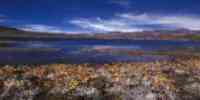
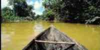
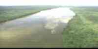
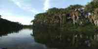
Hydrography
It has an extensive net hidrográfica,
highlighting the river Guarapiche in the
tables. The rivers
they are of little depth, marking the
termination of the piedemonte in which
three are located
fluvial valleys: that of the rivers
Fake-Areo, Guarapiche and Púnceres-Aragua.
They cross the one
state the rivers: Tácata, Tonoro, Carís,
Guanipa and The Tiger.
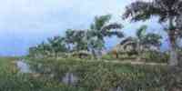
Vegetation
According to the classification of
Holdridge, it corresponds to the forest
humid premontano (Bhp)
in the mountainous area, tropical dry
forest (Bst) and forest humid premontano
(Bhp) in those
tables and plains, presenting the
vegetable formations: forest, gallery
forest, savanna
and forests veraneras.
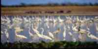
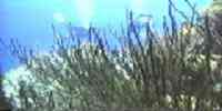
Fauna
Among the birds they highlight: duck
whistler, guacamaya, toucan,
cardenalito and guácharo. Of the
mammals the silky osito and the slight
acure. They are also located
limpet, deer, cachicamo, danta and manatí.
Among the reptiles: cayman of the
Orinoco, dribbles,
morrocoy and iguana, and among the
ophidian ones poisonous, the bell of
Uracoa. The state counts with a
considerable fishing potential. Among
the commercial species they highlight:
lined bagre,
golden bagre, yellow bagre, stubborn
bagre, cachama, curvina, coporo, zapoara
and bass.
Mineral resources
It is, jointly with Anzoátegui, the
region with more potential of oil
resources.
It has important reservations of
hydrocarbons in the Oil Strip of the
Orinoco. Inside
of the non metallic minerals there are
deposits of calcareous, as well as sands
silíceas.
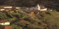
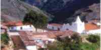
Population
The population is of 470 157 hab
according to the XII General Census of
Population and Housing 1990, being
placed in the sixteenth place among the
federal entities. Their density is of
16,3
Hab/km2. the distribution is the result
of a historical process happened in
function of the
she/he witnesses of water and of other
necessary resources for the subsistence.
The landscapes of
piedemonte and mountain conform spaces
that have been constituted in areas that
you/they offer those bigger
attractiveness for the population's
localization.
The municipality Maturín with the
population's 56,98%, is the most dynamic
in the sixteen
municipalities that integrate the state.
NATIONAL PARKS
It has a single national park: The Guácharo
that harbors the cave of the same name.
It is located in the northeastern
region, in the Solid of Caripe. It
occupies a surface of 62 700
there is.
Economic ACTIVITY
The main economic activity is the
agricultural one. It is the first
producing of yucca and peanut of the one country;
and the second in soya, avocado, palm
oil bottle and eggplant. It is also
cultivated: corn, ajonjolí,
sorghum, cane of sugar, cambur, coffee,
caraota, cotton, tobacco, tomato,
sideburn and orange. As for the
forest activity, it is the third entity
with more production. Those
forest plantations located to the
southeast of the state and the Southwest
of the state Anzoátegui,
they constitute one of the most
important of the country, where they
have put on in production species as
the pine caribe. Other forest resources
are: locust, ceiba, I clot, jabillo,
jobo and
mangrove.
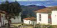
TRADITIONS
In the whole country she/he takes
place in diverse ways December 28, Day
of the Saints
Innocent. In Monagas the manifestation
has its presence through a celebration
popular well-known as the Dance of the
Monkey. It is a dance or of one
improvised
collective choreography in which the
participants are let guide for the
central character, the one
Monkey who dressed in the most similar
way to a simian goes indicating the
steps that should
to execute the present who, some behind
other, in extensive arrays and fellows
for the
waist, the population's streets travel.
Most of people that participate
they darken their faces with soot and
the clothes of colors are tinted. The
Monkey goes giving instructions
precise, it promotes the incorporation
of new dancers and with a whip it
punishes to who not
they complete the instructions.
The party is accompanied by varied
instruments and musical goods among
those that you
they include drums, rope instruments
and, even, steel band.


 Eco-Portal
Wildlife Venezuela
Eco-Portal
Wildlife Venezuela 