TRUJILLO
State
Geopolitical division
It was part of the County of Caracas up to 1786, when it
integrates the County of Maracaibo.
In 1810 it passes to constitute the County of Trujillo. In 1856 it
is one of the veintiún counties of
the Republic and in 1864 state Trujillo is proclaimed. In 1881 it
passed to be part of the Great one
State of you Walk Them. In 1889 it is as state Trujillo. It is
divided in fourteen municipalities and
ninety three parishes.
MAP VIAL
The Pan-American highway communicates to Trujillo with Merida,
Zulia and the center of the country, and the
highway Trasandina leads to Merida and the Western High Plains.
They highlight those
populations of: Betijoque, Boconó, Carache, Carvajal, Chejendé,
The Dividive, Escuque, The
Gulch, Monte Carmelo, Motatán, Pampán, Savanna of Mendoza and
Valera.
Basic DATA
Capital
Trujillo
Location
Region of you Walk them
Limits
North: Lara and Zulia
South: Barinas and Merida
This: Lara and Portuguese
West: Lake of Maracaibo
Surface
7 400 km2
Percentage of the national territory
0,81%. it is the décimaoctava entity with bigger surface of the
country.
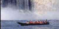
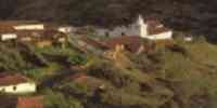
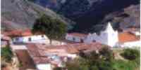
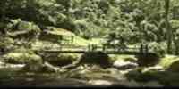
TOURISM
In the capital trujillana they highlight two monuments: the
Monument to the Armistice and the Monument
of the Virgin of the Peace, a statue of 46 m of height. In
Betijoque it is the Parque Esteban
Valera and The Bee, in this last one a beautiful mirador exists
with view to the lake of Maracaibo.
Very close the town of Isnotú is where the Dr. José Gregorio
Hernández was born and in the one which you
finds a chapel and a museum where they attend the devote
ones to pay promises. In Boconó you
finds the Natural Mirador The Hills, Gulch of Boconó,
where it can be practiced the
fishing of trouts. As well as the National Park Guaramacal. In the
near towns to The
Door, specifically in Niquitao, is the church of San Rafael
of the Stone, the one
Monument to the Battle of Niquitao and the Museum Before Columbus
Jacinto González. From here you
it can visit the Moor of Castillejo and Ortiz, and the Teat of
Niquitao. In Valera they are the waters
thermal Alive Water, of Motatán and of Valerita; as well as Saint
John the Baptist church and the one
Museum of Alfredo Tulene.
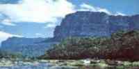
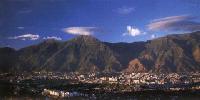
Geography
Geology
The diversity and topographical complexity is product of a
geologic mosaic, where
diverse materials prevail, originated from the precámbrico until
the quaternary one recent,
giving beginning to different processes geomorfológicos: deyección
cones, terraces, valleys,
plains and laundries of mud.
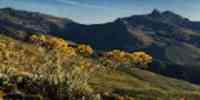
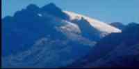
Relief
69% of its surface is mountainous and reduced spaces you fence
intramontanos. 17%
it corresponds to a transition between uneven reliefs and
surrounding low areas and 14%
it is a plane area in form of explayamiento plain and overflow.
The Mountain range of
Trujillo is the spine. This mountain range and the continuation of
the mountain of the North give
origin to two valleys: that of the river Motatán and that of the
river Moboy, separated by a line with heights
superiors to the 2 000 m.s.n.m. Integrating a deep furrow the
valley of the river is developed
Boconó, dominated by lines with superior heights to the 3 000
m.s.n.m. The existence of lands
appropriate for the agriculture it is limited.
Climate
The winds play an important paper, penetrating so much for the
northeast, like for the east
(winds llaneros). The predominant climate corresponds, according
to the classification of Köeppen, to
savanna climate (Aw), with an annual half temperature approached
in the capital of the state of
23,5 °C and precipitations that reach the 936 mm a year.
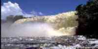
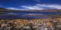
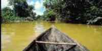
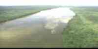
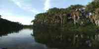
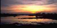
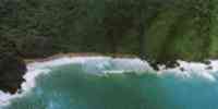
Hydrography
Two big basins exist: that of the river Motatán that pours their
waters in the valley of the lake of
Maracaibo (it is the basin of more surface, and the main source of
available water), being
their tributaries the rivers: Jiménez, Castán, Momboy, Jurijara,
Carache and Monaicito; and the basin of the one
river Boconó that drena their waters to the river Orinoco, this
has great quantity of waters
superficial; their main tributaries are the rivers: Black and
Burate, and the gulches San
Miguel and San Rafael. It has underground waters, marshes, and
sources of thermal waters
(with temperatures of 50 °C), among them: The Bathroom and Hot
Waters; and small mirrors of
it dilutes in the high lands, above the 3 000 m.s.n.m.
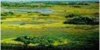
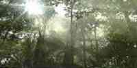
Vegetation
In the areas of more humidity, mainly where the rivers are born
Boconó, Black, Saguás,
Bonilla, Castán, Jirajara and Villegas, and in some sectors of
the low area, the forest prevails
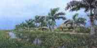
high in very dispersed form. Toward the lacustrine area they
highlight the swamps and the coconut trees.
Forests macrotérmicas alísicas and arboreal vegetation of little
development exist. To the north
the grasses prevail, and in the mountains the landscapes parámeros
extends and they are located
cloudy forests above the 1 700 m.s.n.m., below this vegetable
formations
the forests are happened you mount us and premontanos. Important
forest resources exist
as: samán, jobo, locust, mijao, cedar, will see, ceiba, apamate,
yokel and oak.
Fauna
In some moors and sectors boscosos they inhabit species like: deer
caramerudo and locho,
puma, cachicamo, puercoespín and bear frontino. In the ecosystems
of humid forests and
pluvial they exist: limpet, rabipelado, dove torcaz, mount pava
and guacharaca. In the areas
intervened they inhabit rabipelados, doves white tail and
turtledoves. In the areas moorlands
they highlight the deer matacán and the rabbit paramero. The
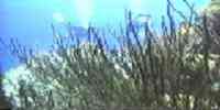
state possesses a fishing potential, the one
which is restricted to the continental fishing that is carried out
in the sector suroriental of the one
lake of Maracaibo and in the net hidrográfica constituted by
rivers, gulches, and in smaller
proportion, lagoons.
Mineral resources
The mineral and energy resources are represented for: sands silíceas,
limestone, silica,
granite, feldespato, mica, phosphates, dolomita and clay, besides
an area of oil interest,
in the alluvial plains of the rivers Paují, Caño Carrillo and
right margin of the river Motatán.
Population
It occupies the fourteenth place with regard to the national
total, with a population of 493 912 hab
according to the XII General Census of Population and Housing
1990. The density is of 70,3 hab/km2.
As for the population's distribution, the municipalities with
bigger quantity of inhabitants
they are: Valera (22,35%), Boconó (15,22%) and Trujillo (11,73%).
starting from 1950, the rhythm of
the population's growth diminished progressively. These descents
are explained by the one
I process migratory that has affected to the entity, as
consequence of the decline of its
economy low cafetelera the global effects of the oil impact of the
country.
NATIONAL PARKS
It has three national parks: Dinira, in the Sierra of Barbecues,
in the nascent of the river
Tocuyo, embracing the states Lara, Trujillo and Portuguese. Moor
of Guaramacal, in the
Serranía of Guaramacal, in the brunch this of you Walk them of
occident of the country. Sierra of The
Breech, in the mountainous region of the Mountain range of you
Walk them, to the north of Merida.
Economic ACTIVITY
It is based on the agricultural activity. It occupies the first
place as for the cambur production,
banana and pea of the country; the second in potato, lettuce,
carrot, beet, cabbage and pineapple; and
the third in celery, cauliflower, sheath and garlic. It is also
cultivated: coffee, cane of sugar, corn, caraota
and yucca. In the sector agricultural animal it highlights the
cattle raising of bovine and the swinish cattle raising. In
the fishing sector: curvina, cazón, white bagre and white shrimp
are the main ones
products. As for the industries they highlight: rock fosfática,
cement, coal, devices
appliances, nutritious products and drinks.
TRADITIONS
The party of The Midgets and the Doll of The Calenda is typical of
the state Trujillo and she associates with
the festivities of Christmas and Carnival. Time behind a Midget,
painted in the belly of a
dancer, danced for the streets of the town to the they are of the
Christmas gifts. On the other hand The was
Calenda, an enormous doll that left to celebrate during the
carnivalesque time. At the moment
an assembly created by Alberto Aranguren in which a group of
midgets dances exists next to
the Doll of The Calenda. The music that accompanies to the
representation is the Polka, which is
executed with mandolin, violin, guitar, maracas and drum. Another
of the traditions characteristic of
Trujillo is that of the Shepherds and Kings Magos that
takes place between the 4 and January 7. From
the villages lower peasants' groups that take images and flags to
attend the
Sacred Mass January 6. The shepherds group in Departures and they
go in lines toward the church
hitting the canes that take in the hand. After the mass it goes
out the procession with the
image of the Niño Jesús that then place in an altar in the
entrance of the church. In the afternoon,
Kings Magos end up in their horses to surrender him I pay the Niño
Jesús.


 Eco-Portal
Wildlife Venezuela
Eco-Portal
Wildlife Venezuela 