ZULIA
State
Geopolitical division
In 1676 Maracaibo it was added to the County of Merida of the
Sacred Spirit of Screams Her. In
1824 are formed the Departamento Zulia. In 1864 it becomes state.
In 1867 they are united Merida and
Táchira. At the end of the century Zulia and Falcon pass to form
a single entity: Falcon. When being
dissolved, conforms to the state Zulia. It is divided in
seventeen municipalities and hundred six
parishes.
MAP VIAL
The most important road is the troncal 6 that leads to Táchira.
also communicates with Lara
for the troncal 17, with Falcon for 3 o'clock, and with Merida and
Trujillo for the troncal 1. Among those
populations highlight: Bachaquero, Bobures, Cabimas, Ciudad Ojeda,
Cojoro, Concepción,
Lagunillas, Paraguaipoa, San Rafael, San Carlos of the Zulia,
Santa Rita, Sinamaica and Villa of the one
Rosario.
Basic DATA
Capital
Maracaibo
Location
Region Zuliana
Limits
North: Caribbean Sea
South: Merida and Táchira
This: Falcon, Lara and Trujillo
West: Colombia
Surface 63 100 km2. The total surface, 50 230 km2, they are continental
lands, the 12 870 km2 remaining
they are occupied by the lake of Maracaibo and the gulf of
Venezuela.
Percentage of the national territory
6,88%. it is the fifth entity with bigger surface of the country,
without considering the island of Toas.
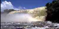
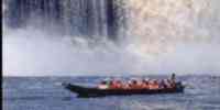
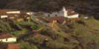
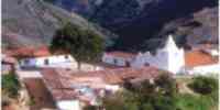
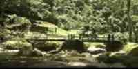
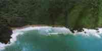
TOURISM
Santa Ana's Chapel, the Cathedral, Santa Bárbara church and the
is in Maracaibo
Basilica of Chiquinquirá. They are also the Museums:
Arquidiocesano, of Arts
Graphic and Urdaneta. As well as the walk of the Sciences, the
Planetary Simón Bolívar and the one
Bridge Rafael Urdaneta or Bridge on the Lake of Maracaibo. Very
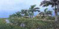
close the Marsh is of
the Olive trees and Santa Rosa of Water, where they are still some
palafitos. The one is in Bobures
Municipal spa, the beaches San José and Santa María, and the
river Catatumbo, where takes place
the Lightning of the Catatumbo. The beach Punta Hicotea is in
Cabimas and in Ciudad Ojeda the
beach Stops there. The Park National Marshes of the Catatumbo is
in Opposing. In
Machiques, the National Park Sierra of Perijá and the Indigenous
Mission of the Tukuko. In Mene
Big is the Refinery San Lorenzo and the Monument to the Oil
Nationalization.
In San Rafael of the Moján the beaches Villalobos, The Mercedes
and The Palms; the Lagoon of
Sinamaica, with the palafitos that stay almost intact; as well as
the castles: of Our
Mrs. of the Carmen, of San Carlos of the Bar and of Santa Rosa of
it Undermined.
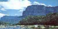
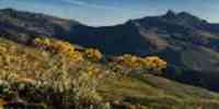
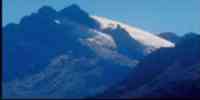
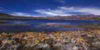
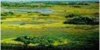
Geography
Relief
It is located on a basin limited by a mountainous system: the
Sierra of Perijá and the
Mountain range of you walk them. In their interior a busy sinking
grave opens up for the lake of
Maracaibo. The Continental Platform and the lake of Maracaibo
(body of sweet water more
extensive of Latin America) they conform 3,5% of the total of the
gulf of Venezuela. The plains
coastal of the Peasant with valleys fluvio-marines, padded
lacustrinos, landscapes of the marine coast
and eolic plains. The Plateau Maracaibo-Machiques with landscapes
of plane relief and
wavy, denudación plains and explayamiento, hills, hills
piedemontinas of the Sierra
of Perijá and low mountains. The Sierra of Perijá formed by
serranías of uneven relief,
with maximum heights of 3 750 m.s.n.m. The Recent Alluvial
Depression of the lake of Maracaibo
occupied by the lake and extensive alluvial plains, of
explayamiento, overflow and
muddy. The floors are sandy in the coast and in the plane lands,
while the southeast
of the lacustrine depression they are aluvionales and of fertile
lands.
Climate
The annual half temperature oscillates between 18 and 26°
Celsius. The climate, to the north, is semi-arid with
an annual half temperature of 27,8 °C, and a half precipitation
that oscillates between 300 and 660
mm. To the south is more humid, identified as tropical of savanna
(Aw), with a precipitation
mediates that varies among 500 to 1 000 mm.
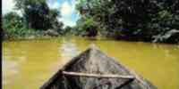
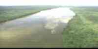
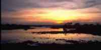
Hydrography
The valley of the lake of Maracaibo has an extensive net hidrográfica
formed by the basins of
the rivers: Lemon, Palmar, Apón, Santa Ana, Catatumbo, Escalante,
Chama-Pocó, Misoa,
Machango, Old Town and Take-the Palmar. The lagoon of Cocinetas is
one of the more ones
important. They highlight the reservoirs of the Hydraulic Complex
Luciano Urdaneta.
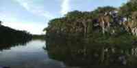
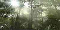
Vegetation
It includes espinares, heaths, swamps and communities xerófilas
in the coastal plains,
forests tropófilas, forests perennifolios in the Piedemonte South
Colinoso of Perijá and forests
semideciduos, the same as heaths in the Serranía of Ziruma. It
possesses forest resources,
among those that highlight: bacú, cinnamon tree, cedar, ceiba,
naked Indian, jobo and pomarrosa.
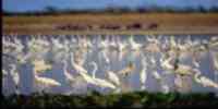
Fauna
They exist hábitats that constitute reservorios, as the Sierra of
Perijá and the humid atmospheres
coastal. The most excellent mammals are: I dare melero of the
Zulia, river dolphin, picure zuliano,
chigüire and laziness of two fingers. Among the birds: chicagüire,
endemic species of the basin of the one
lake, galandra, paují stone crest, partridge montañera and marsh
polla. The reptiles
important they are: lizard basilisk, iguana and black morrocoy of
the Zulia. The fishing resources
of the lake they are represented for: bass, jurel, carite,
bocachico, manamana and curvina.
Mineral resources
It harbors 80% of the proven reservations and semiprobadas of
petroleum of the country, 20% of those
reservations of natural gas and 92% of the reservations of mineral
coal; besides counting with:
get paid, dolimita, limestone, clay and phosphate. Also bill with
locations of sands silíceas,
baritas, calcareous and salt.
Population
The entity with bigger population of the country, with 2 235 305
hab according to the XII general Census of
Population and Housing 1990. During the period 1981-1990 the
population experienced a rate
of growth of 3,3%. with regard to the distribution of the
inhabitants, concentrates on the one
municipality Maracaibo (54,62%). Followed by the municipalities:
Cabimas (8,86%) and Lagunillas
(4,89%). Zulia is population's receiving state, not only of other
entities of the country, but
that for their border position, it attracts to great quantity of
Colombians that look for in Venezuela
better employment opportunities.
NATIONAL PARKS
It possesses two National Parks: Sierra of Perijá, located in the
Mountain range of Perijá, in the one
extreme suroccidental, in the frontier with Colombia. Juan
Manuel's Marshes or
Marshes of the Catatumbo, to the Southwest of the lake of
Maracaibo.
Economic ACTIVITY
Their economy depends on the petroleum. The oil activity is
carried out in an intensive way,
generating an entrance that overcomes the regional domain, because
it is the main sustenance of the
national economy. It covers 80% of the national production of
petroleum and hydrocarbons. The high one
potential of the floors of the south of the lake of Maracaibo,
they allow an agricultural development and
significant cattleman. It is the first producing of diverse
agricultural and cattle items: palm
oil bottle, grape, milk, cheese, bovine livestock, ovino and
birds; the second in eggs and the third in
cambur, banana and won caprino. It is also cultivated: cane of
sugar, coconut, yucca, cotton,
bean, melon and sorghum. The forest production is also
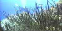
significant. The marine resources him
they transform into the second supplier of fish of the country. In
the lake it is fished: bass, jurel,
carite, bocachico, manamana and curvina, and in the lagoon of
Cocinetas: cazón, jurel, mere and
pargo. The shrimp was abundant in times previous to the seventies,
when the began
saturation of crafts rake-pescadoras that drove to their decrease.
TRADITIONS
Although the bagpipe is a musical gender that one interprets with
its respective variants in
many states of Venezuela, it is in the Zulia where has
found their biggest development. You
they distinguish: Santa Lucía's bagpipe, the bagpipe of Tambora,
the Gaita Perijanera and the bagpipe of Furro.
This last one is also known as bagpipe Maracaibera, and it is one
of those more diffused in
the whole national territory. It is not tasted like certain
science where was born, but The Empedrao and
Saladillo is the quarters that are disputed the origin of the
bagpipe of Furro. Their chords
they begin to be listened in the month of October and they don't
rest until January. Although they are had
incorporate different instruments, a typical instrumental group is
formed by four,
maraca, charrasca, drum and furro. This last one, also called
furruco, it is indispensable.
The topics of the compositions are very varied, they go from the
protest or social accusation,
going by the cotidianidad, the country, the love, the Virgin of
Chiquinquirá and San Benito.


 Eco-Portal
Wildlife Venezuela
Eco-Portal
Wildlife Venezuela 