STATE
APURE
Geopolitical division
It was part of the County of Merida of the Sacred
Spirit of she/he Screams her. To the anexársele
Maracaibo,
it was denominated County of Maracaibo. In the XIX
century it integrated the county of Barinas. In 1856
it is erected as county, and in 1864 she/he acquires
the state range. In 1881 form, with Guayana,
the state Bolivar. It is reestablished as state in
1909. It is conformed by seven
municipalities and twenty-six parishes.
MAP VIAL
The vialidad of it Hurries it is limited and she/he
concentrates on a main highway that crosses the one
Plain of this to west, uniting to their capital with
Bruzual and Puerto Nutrias, toward Barinas, and San
Cristobal via Guasdualito. The rest is highways you
truncate them. Their main cities are:
Achaguas, Biruaca, Bruzual, The Help, Elorza,
Guasdualito, The Victoria, Puerto Páez and San
Juan of Payara.
Basic DATA
Capital
San Fernando of it Hurries.
Location
Region of the Plains and of you Walk them.
Limits
North: Guárico, Barinas and Táchira.
South: Colombia.
This: Bolivar.
West: Colombia.
Surface
76 500 km2.
Percentage of the national territory
8,35%. it is the third entity with bigger surface of
the country.
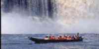
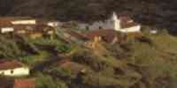
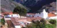
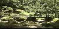
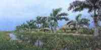
TOURISM
The tourism is developed, fundamentally, in clusters
located plain inside, where they prepare
packages that include walks at first hour of the
morning to see the garceros and
trips to observe the rich and varied fauna of the
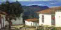
region. In San Fernando of it Hurries it is
the Palace of Barbarian, of Florentine architecture
and that it represents the times of glory of the one
state, when they exported Europe the sought-after
heron feathers and the cayman skins.
It also highlights in the capital The Cathedral, a
colonial construction of the XIX century, and the
Square
Camejo, with a statue in brass of Pedro Camejo, the
famous lancero llanero. Among the rivers
Hurry and Difficulty is the islands The Black one and
The Palomera. In Achaguas two exist
attractive spas: Matiyure and River Hurries. Another
place of interest is the Help of it Hurries, in the
one
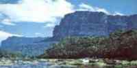
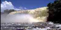
border step toward the Colombian Arauca. In Puerto Páez
they are the Tidelands of
Cinaruco, an unprecedented visual show.
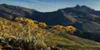
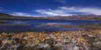
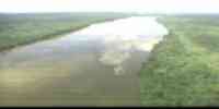
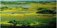
Geography
Geology
The plains are conformed by not consolidated silts or
little consolidated and for
alluvial deposits. They present a fisiografía
dominated by the plains of the Plains
Western that occupy 75% of the surface of the state.
It has landscapes of
table plateau, inclined planes, piedemonte, mountains
and valleys. The floors
predominant they are ultisols enough evolved, with
clay accumulation in the profile,
acids and of low saturation of bases and nutritious.
They are saturated of water by the long ones
humid periods to that you/they are subjected during
great part of the year. Also they see each other
influenced by the long dry station, what hinders their
use for the use
agricultural.
Relief
The plains go from the fork of the rivers it Hurries,
Arauca and Capanaparo with the Orinoco
until the Andean piedemonte. They are differentiated
in alluvial, oozy and eolic that
they constitute plains of it overflows and
explayamiento, plane reliefs, areas of dunes and
deltaic plains. The characteristic units are banks,
first floor and tidelands, these two last
subject to seasonal floods due to their soft slope.
The table plateaus
they present diverse types of landscapes fisiográficos.
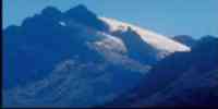
The piedemonte and the mountains are part of
the portion of the Andean mountain range; their
variations of slopes go from 4 to 15%. In the
landscape
of mountain, the variations of height accentuate
abrupt reliefs, with slopes of 65%.
Climate
The annual half temperature is of 25,7 °C. The
precipitations oscillate between 700 and 1 500 mm
annual. There are several types of climates: tropical
dry forest (bs-t), associated to the plains
alluvial and eolic, table plateaus, glacis and some
valleys; tropical humid forest (bh-t)
in the piedemonte and the humid plains; and the
mountain area with a transition among
tropical very humid forest (bmh-t) to forest humid
montano (bh-m). it Presents two
park: a rainy period from May until October and other
dry, from November until
April.
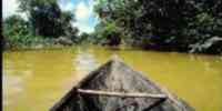
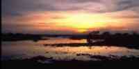
Hydrography
A parallel pattern presents with orientation
west-this. It has a system formed for
four main rivers: Hurry, Arauca, Capanaparo and Goal
in their low basin that you/they are born in the
Mountain range of you Walk them and they pour their
waters in the Orinoco. Other rivers of importance are:
Arichuna, Cinaruco, Cunaviche, Guaritico, Matiyure,
Sarae in their low basin and Uribante in its
low basin. In the plains hurries us 21% it is
generated from the total glide to the north of the
river
Orinoco. Underground sources of high yield exist, as
those that are among
Achaguas and San Fernando.
Vegetation
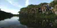
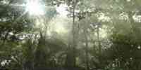
The savanna vegetation prevails, inserted with gallery
forests in the riverbanks of
the rivers. To the west it highlights San Camilo's
cloudy forest. The forest potential is
represented in a surface covered with forests of 9,2%
of the total estadal. The forests
producers cover 5,3% of this surface.
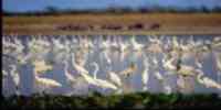
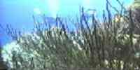
Fauna
It is located in the gallery forests, in the pipes and
in the lagoons. Among the mammals
they highlight: chigüire, deer caramerudo, bear
palmero, tonina and cachicamo sabanero. The birds
more important: welded garzón, blue palette,
overcoat, duck guirirí rosy pick and sparrow hawk
red. The reptiles as dribble, snake of water, turtle
arrau and cayman of the Orinoco are
common. The most frequent amphibian is the frog
jumper. The net hídrica constitutes a reservorio
of fauna where the fishing can be developed and to be
practiced the piscicultura. The fauna variety
it presents a potential estimated in 9 259 TM.
Mineral resources
They are very limited because great part of the plains
it is constituted by silts
soft of the third superior and quaternary recent. Some
iron manifestations exist
in the sector Galley of the Cinaruco and the presence
of hydrocarbons in the oil strip Hurries -
Barinas.
Population
With base in the populational development, Hurry it
locates in the nineteenth place with regard to the one
total national, with a population of 285 412 hab and a
populational density of 3,7 hab/km2.
The population, according to the XII General Census of
Population and Housing 1990, evidences a
extensive territory of spaces semipoblados. For the
last period intercensal the rate of
growth was of 4,7%, almost double the national
average. As for the distribution, there is
a concentration in San Fernando's metropolitan area of
it Hurries with 33,96%. This
area corresponds to San Fernando's populated centers,
Biruaca and The Recess. They continue him those
municipalities of Páez (22,13%) and Achaguas
(14,77%). To the south of the state they are located
several
indigenous groups, the group ethnic guahíbo whose
communities are located in those highlighting
riversides of the rivers Capanaparo, Cinaruco and
Goal, and in smaller proportion communities exist
cuivas, pumés, amoruas and capuruchanas. Hurry it has
been pole of attraction for immigrants
Colombian, well be to settle there or I eat traffic
toward other regions.
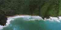
NATIONAL PARKS
It possesses three national parks: Old river, which
occupies 68 200 hectares of the high plains
western, in the end west, in the frontier with
Colombia; Cinaruco-Capanaparo, with
584 368 hectares in the western low plains; and The
Tamá whose surface embraces 109 100
hectares to the beginning of the mountainous system of
you Walk them.
Economic ACTIVITY
The fundamental economic activity is the agricultural
one. There is predominance of the cattle raising
bovine locating you as second producing of the
country. In the last times it has been developed
successfully the breeding of buffalos. In the
agricultural sector, it is the second producing of
cotton, bean
and yucca, and the third in cocoa. It is also
cultivated: caraota, cambur, banana and corn. The
fishing is
a traditional and reduced activity at local level. The
industrial activity is incipient, a little
diversified, concentrated on San Fernando and
Guasdualito.
Their more important forest resources are: cedar,
masaguaro, stick of water, samán and saqui -
saqui.
TRADITIONS
Although it is a music that is interpreted in the
whole country, Hurry it presents as the earth for
excellence of the joropo. A single joropo type doesn't
exist, there are many modalities that you/they have
gone
arising along the time. In the western Plains to the
forms primigenias –galerón,
pajarillo and number - they have been added variants
as the ring that hums, the periquera, the one
overcoat, the six for right, the sparrow hawk, the
quirpa, the chipola, the corrío, the cunavichero, the
one
quitapesares, and the own passage apureño, the
representation llanera for antonomasia. The joropo
it is interpreted, basically, with harp, four and
maraca, more the voice. However, in Barinas,
Portuguese and in certain areas of she/he Hurries it
doesn't use the harp, but the bandola like instrument
contrapuntal. He disputes, in their different
expressions, it is essential part of the joropo. There
is
two contrapunteos: the one that takes place among the
instruments and the voice and the one that one gives
between two or
more singers starting from the improvisation of verses
and ballads. Every year they are carried out those
“Parties of Elorza”, where the joropo charges life
and it remembers a tradition that goes back to the one
XVII century and it remits to old songs and Spanish
dances.


 Eco-Portal
Wildlife Venezuela
Eco-Portal
Wildlife Venezuela 