COJEDES State
Geopolitical division
In 1830 figure in the County of Carabobo. In
1855 two counties are believed: one with the one
same name and another call Cojedes. In 1864
becomes state. In 1881 form the one
South state of West. In 1891 the Great Estado
Zamora is believed. In 1899 it is again
state. In 1904 it integrates the state Zamora.
In 1909 it recovers their autonomy. It is
divided in seven municipalities and fifteen parishes.
MAP VIAL Road-Maps
The system vial is short if it is compared with
the surface of the state. The used roads
they are: the troncal 8 that takes to Barinas;
the 13 that goes at Guárico and the 5
that it drives to Portuguese, Carabobo and the center of the country. It is in
construction the freeway from San Carlos to
Acarigua. Among the important populations they are
counted: The Vegas, The Trunk, The Pao, Freedom,
Tinaco and Tinaquillo.
Basic DATA
Capital
San Carlos.
Location
Central region.
Limits
North: Carabobo and Yaracuy.
South: Barinas.
This: Guárico.
West: Portuguese.
Surface
14 800 km2.
Percentage of the national territory
1,61%. it is the thirteenth entity with bigger
surface of the country.
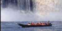
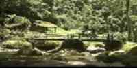
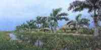
TOURISM
One of the big attractiveness is to enjoy the
animals and of the plants of the Hato Piñero,
in
The Trunk. In May takes place in the
capital the Fair of the Mango, the regional
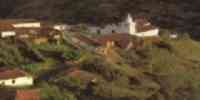
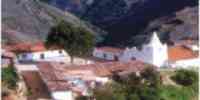
fruit. In San Carlos it is the House of the Culture The Blanquera,
installed in a construction that dates of the
XVIII century, where Bolivar planned the Battle of Carabobo;
the Immaculate Concepción's church,
built in the XV century; that of Saint John the
Baptist erected among the XVII and XVIII
centuries; and the one of Sacred Domingo, only that has not been remodeled
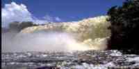
from their creation in the XIX century. Also of San Carlos' famous Racing circuit. In Tinaco
they are the thermal waters The
Sulfurous and the spa The Jump. And in
Tinaquillo, the thermal waters The Aguadita and
the reservoir of Cachinche, fork of the rivers Paíto and
Chirgua.
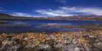
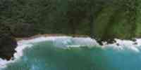
Geography
Geology
In the mountain landscapes and piedemonte there
are materials of the era mesozoica, beginning
the one system deposicional with a basal conglomerate of
quartz fragments and granite, happening
of calcareous to a series of calcareous schists.
In an immediate way the positions
piedemontinas concludes to open the way to the
landscape llanero of quaternary origin.
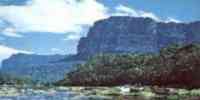
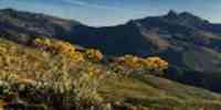
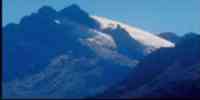
Relief
The mountain landscape (that includes the slopes
of the Serranía of the Interior) has
heights
I average from 800 to 1 000 m.s.n.m., and it is
conformed by wavy slopes to accident victims
with slopes of 30-50% and bigger to 50%, besides
straits you fence intramontanos. In the one
piedemonte dominates the wavy hills to accident
victims, and the low hills, with slopes
smaller to 60% and heights average of 400
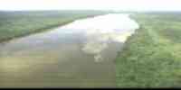
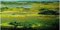
m.s.n.m. The landscape llanero embraces near 71%
of the one state. It is subdivided in: high plains of
intermediate alluvial plains and low plains, of
alluvial plains with a sedimentation of the
deltaic type with wide plane areas and
depressions.
Climate
According to the classification of Köeppen, the
climate is of savanna (Aw), with small
variations
climatic. The annual half temperature is of 26,1°
Celsius, coinciding the maximum registrations
and minimum with the dry and humid months,
respectively. The precipitation annual average
it varies among 1 300 -1 600 mm, increasing you
among 1 900-2 000 mm in the areas
mountainous.
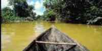
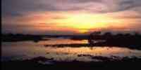
Hydrography
The net main hidrográfica is part of the
subcuenca of the Portuguese river, conformed for
five big rivers: Cojedes, San Carlos (Tirgua),
Tinaco, Pao and Chirgua. The high basins of
these rivers have great importance for the
socioeconomic sustenance of the region.
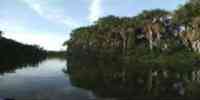
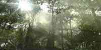
Vegetation
In the mountainous areas it dominates the
vegetation of clear bushes, herbazales and
forests
dispersed; in some valleys intramontanos exists.
The positions piedemontinas and the landscape
llanero is conformed by hoisted savannas. The
forest potential is bounded to those
lots boscosos llaneros, where there are species
of high commercial value as: saqui-saqui, samán,
mijao, jobo, I dredge, apamate, cedar, ceiba,
jabillo, charo, carocaro, mahogany, camoruco,
carabalí,
locust and sucking.
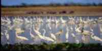
Fauna
They are counted among the mammals: báquiro
white cheek and deer caramerudo; in the galleys
it is frequent to see pumas and tigers. Among
the birds is a variety of blue, as well
as
real parrot, Brazilian duck, sparrow hawk
whistles deer and paraulata llanera. The bell,
the one kills real and the one
cayman of the Orinoco is the better known
reptiles. Among the amphibians: toad and frog
platanera.
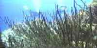
Two fishing areas are presented that they offer
a high potentiality. The fishing area of
flood that extends from the left riverbank of
the Portuguese river until the north of the one
state; and the ribazón area or summer that it
covers the Portuguese river and extends
toward the south,
until reaching the pipe Igües and their fork
with the river Guanarito.
Mineral resources
They concentrate on the mountainous region to
the north and the solid of The Trunk. The
locations of
metallic minerals are associated to the
formation Tiramuto and to the complex The
Tinaco. In the one
first lead deposits, zinc and copper exist,
while in the second there are reservations of
nickel that you/they can be exploited to open
sky. The most important non metallic minerals
they are: asbestos (the main deposits of
Venezuela are located to the northwest of
Tinaquillo),
bentonita, cianita, feldespato, graphite, sand,
burdens, limestone, talc, granite, magnesita and
washes ornamental.
Population
According to the XII General Census of
Population and Housing 1990 their population is
of 182 066 hab, for
what occupies the twentieth second place with
regard to the national total. Their populational
density
it is of 12,3 hab/km2. The main urban centers
are: San Carlos, Tinaquillo, Tinaco, Those
Vegas and The Trunk. The occupation pattern and
space operation is characterized by a drop
populational density to the south, in the sector
of the plains, and a marked urban concentration
to the one center-north, mainly in the piedemonte, where
the municipalities are located San Carlos
(38,02%), falcon (26,55%) and Tinaco (13,97%).
NATIONAL PARKS
It has a single national park: Tirgua (General
Manuel Manrique) whose surface is of
91 000 hectares and it embraces the
municipalities San Carlos and Anzoátegui, and
the municipality Nirgua of the one
Yaracuy.
Economic ACTIVITY
The industrial activity is precarious, being the
agricultural one the economic base of the state.
It is the one first producing of batata, of quinchoncho and of
tobacco; the second in ajonjolí, and the third producing of rice, of yam and of mango of the
country. Other cultivated products are: corn,
sorghum, yucca, coffee and cane of sugar. In the cattle
sector they dominate the bovine cattle raising
(their main one economic resource) and swinish. The timber
production, based initially on the extraction irrational of fine species,
has gone
toward the calls hard and soft wood,
shrinking the productive capacity of the
forests. It has some industries of self-driven, spun reserves, furniture and
electric materials.
TRADITIONS
The spree is a traditional musical expression,
characteristic of the Christmas that one
manifests
fundamentally in the states Carabobo, part of
Aragua and in Cojedes. The grouping,
integrated by musicians that interpret topics
accompanied by furruco, maraca, guitar,
four, violin, mandolins and charrascas, they go
of house at home singing to the birth. To
inclination of its verses requests permission to
the owner of the habitation to begin its task.
Later on they sing the boy Jesus, and later they
intone ballads to the present, concluding
with the petition of the respective Christmas
gifts for the members of the grouping. Those
sprees are identified by the name and a certain
color that capture in the shirts and
in the flags that behave. Also, they take
enormous handkerchiefs placed on the shoulders.
Heading the spree a character that takes a
streetlight or star goes always. Those
older groupings are The Flower of Cojedes and
the Verdeclarita of the state Carabobo. The
first is 60 years old celebrating this
ritual in the houses of the central state that
gives him name.


 Eco-Portal
Wildlife Venezuela
Eco-Portal
Wildlife Venezuela 